Archaeo-Physics, LLC is a consulting firm specializing in non-invasive archaeological exploration.
We use geophysical survey and remote sensing for high-resolution subsurface imaging, integrated analysis of archaeological sites and landscapes, cemeteries, and forensics. These techniques can reveal phenomena not otherwise discoverable, and map patterning at scales and level of detail infeasible with conventional methods. This cannot replace traditional approaches, but can vastly expand upon them. When used to guide excavation, the cost of research can be reduced while maximizing the recovery of useful data. Because geophysical and remote sensing are non-invasive, they are important tools for preservation and research on culturally sensitive or protected sites.
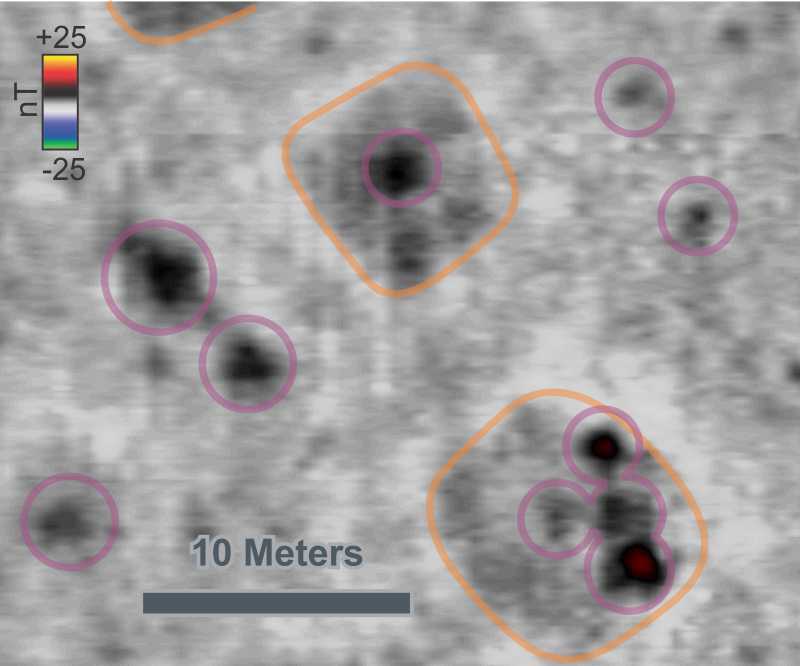
Featured case study: Krasni Yar, a Copper Age Botai Culture settlement in Kazakhstan
Pit houses, hearths, and other features are mapped with magnetic and electrical resistance survey as part of research into the earliest horse domestication.
 Follow us on facebook
Archaeo-Physics projects in the news:
- High-Tech Archaeology Helps Uncover Stories Of Long-Lost Gold Miners, KUOW News
- Treading lightly: Non-intrusive methods used to chart Ojibwe burial grounds, Duluth News Tribune
- Continuing search for bodies reveals mass grave at Mission Santa Inés, Lompoc Record
- This is why Afton is scanning for ancient Indian burial mounds, Saint Paul Pioneer Press
- Digging for what’s beneath the surface: Film crew, archaeologists back at Kensington Rune Stone Park, Alexandria Echo Press
- ‘Digless’ archaeology – Mission researching its history, Santa Ynez Valley News
- Secrets of the stone house, Minneapolis StarTribune
- New Technologies (and Tires) Reconstruct Ancient Bison Hunts, UA News
- Optical spectroscopy instrument development at two historic Native American sites, Kansas Preservation
- Dirt Has Stories to Tell research at Fool Chief Village in Kansas, Topeka Capitol Journal
Publications by archaeophysics staff