During the Summers of 2000 and 2001, Archaeo-Physics conducted magnetic field gradient and electrical resistance surveys at Tell Ahmar (also known as Til Barsib or Til Barsip), in northern Syria. This very large scale geophysical survey mapped much of the ancient city plan.
Tell Ahmar has been occupied from at least the Neolithic up to the present village. It was an important regional center during the Iron Age, with notable Hittite and Neo-Assyrian occupations.The objectives of the investigation were to locate and identify subsurface architectural or archaeological features, and to reveal as much of the city plan as possible. particularly in non-elite areas, which had been largely unexplored.
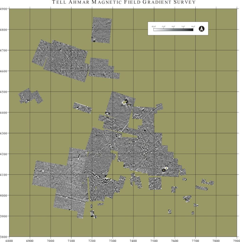
Nearly 40 hectares of the site were surveyed with magnetic gradiometers. Several hectares were also surveyed with an electrical resistance meter. These two methods proved to be successful and complementary to each other. Numerous archaeological features have been identified based on geophysical anomalies, as well as large areas containing high densities of features and probably complex stratigraphy. Features composed of mud brick, basalt and limestone appear to be identifiable in the geophysical data, as well as other anomalies that may be caused by organically enriched soils, cobble pavements and ditches.
Basalt building stone, fired brick, and rather massive pottery are all common components of the archaeological deposits at Tell Ahmar. These materials have a remanent, or permanent magnetic field which appears in the data as a bipolar (having both a positive and negative component) anomaly. The magnetic signatures can be confused with that of ferrous metal. It is therefore not possible to always distinguish bipolar features of ancient origin, but the pattern or configuration of many of these anomalies indicates that they are ancient in origin.
Mud brick or limestone architecture appears as subtle magnetic lows, because these materials have a lower magnetic susceptibility than the surrounding soil.
Because the soils have a high magnetic susceptibility, small scale topographic variation can produce rather strong anomalies. Irrigation ditches and alternating rows and furrows cause anomalies in this survey area which are often stronger than those associated with ancient architectural features, but can be distinguished by their patterning.
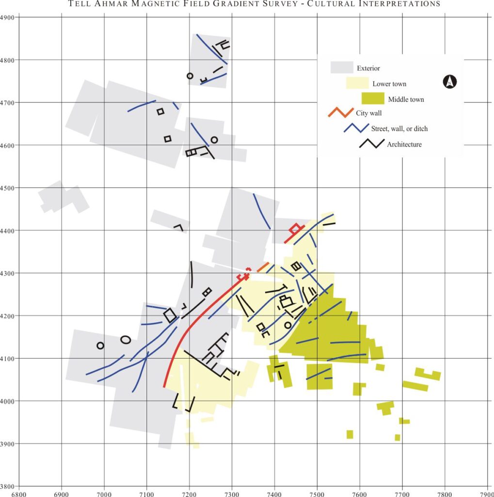
Based on the results of this survey, certain conclusions can be tentatively drawn regarding types of features and settlement patterns. Three fairly distinct zones of occupation are posited based on the geophysical data: An inner urban zone characterized by high population density, and many closely spaced buildings; an exterior urban zone and the city wall, characterized by low population densities and monumental architecture; and a sparsely settled agricultural zone outside the city wall. Examples are shown below.
City Wall and Monumental Architecture
Until this survey, the location of the western portion of the city wall was unknown. The magnetic data plot below shows the city wall and a zone typified by monumental architecture just within the wall.
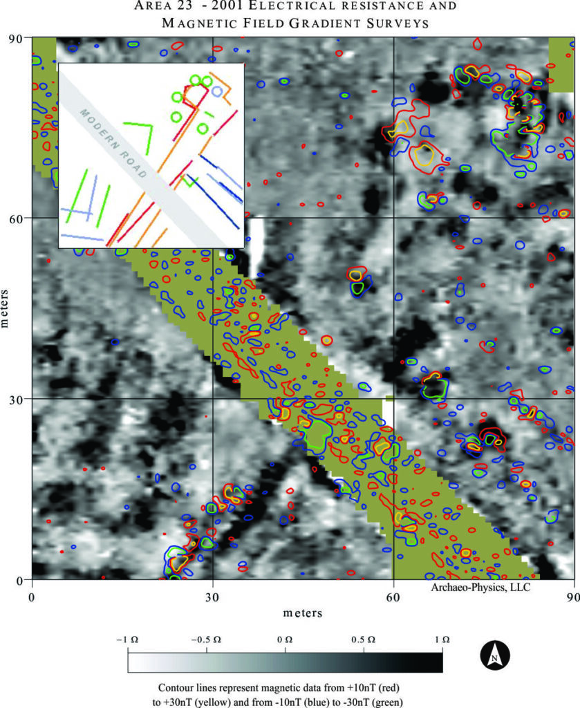
Orange – magnetic anomalies associated with city wall
Red – resistance anomalies associated with city wall
Dark blue – other magnetic anomalies
Light Blue – low resistance anomalies
Green – high resistance anomalies
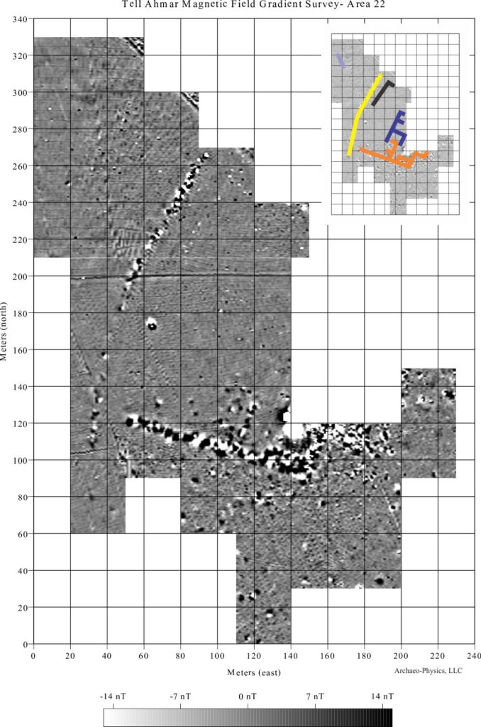
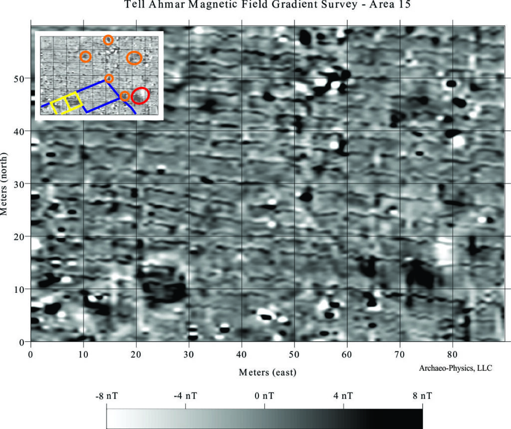
Exterior Zone Isolated farmstead
Outside the city wall seems to be a sparsely settled agricultural zone. Widely scattered one or two room buildings, often with associated walls or other long, linear features characterize this zone. These are thought to represent isolated farmsteads. Without testing, the age of these features is indeterminate. The example below is not dissimilar to the modern farmsteads in the vicinity, but lacks the concentration of metal debris that would be expected around a modern dwelling. Ferrous metal debris (wire, cans, nails, bottle caps…) is pervasive in modern habitation and activity areas, and the strong response to these materials tends to dominate the magnetic environment.
Because the soils have a high magnetic susceptibility, small scale topographic variation can produce rather strong anomalies. Irrigation ditches and alternating rows and furrows cause anomalies in this survey area which are often stronger than those associated with ancient architectural features, but can be distinguished by their patterning.
The Geophysical Investigation at was under the direction of John M. Russell (Massachusetts College of Art). The Archaeological expedition at Tell Ahmar was under the direction Dr. Guy Bunnens (University of Liege, Belgium).
The geophysical investigation was sponsored by:
Selz Foundation
Institute for Aegean Prehistory
National Geographic Society
Davis Educational Foundation
Raymond and Beverly Sackler
Curtiss T. and Mary G. Brennan Foundation
Linda Noe Laine Foundation
Adelard A. and Valeda Lea Roy Foundation
Norman Solhkhah
Massachusetts College of Art