The following case studies in archaeological prospection were selected from among hundreds of surveys performed by Archaeo-Physics staff members. Examples were selected to illustrate geophysical applications in a variety of contexts and issues in methodology and interpretation.
Calvary Cemetery Subsurface radar imaging of a 19th century ‘receiving tomb’. Ground penetrating radar was used to verify the existence of a rumored historic tomb. Three dimensional modeling and animation are used to explore its structure.
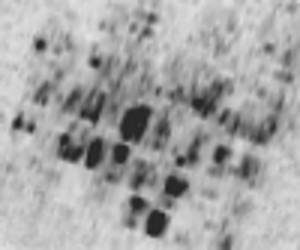
Magnetic prospection for datable materials Thermal features, such as hearths and burned structures, are often detectable in magnetic surveys. These features are rich sources of archaeological data. In particular, thermal features are sought as sources of datable material. Most often this is carbon for radiometric dating, but they can also provide material to be dated by other techniques, including archaeomagnetism and thermoluminescence.
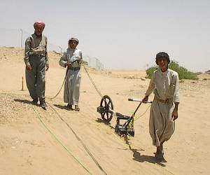
Tell Ahmar (Til Barsib) Large-scale geophysical mapping of an important Hittite and Assyrian urban center in northern Syria.
Gladstone Shops of the St. Paul and Duluth R.R. Ground penetrating radar (GPR) survey and Lidar analysis of a 19th century railroad roundhouse and associated shops.
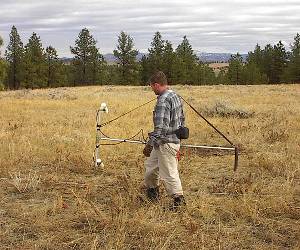
The Kutoyis Bison Kill Site A late prehistoric/ancestral Blackfoot buffalo jump and processing camp in northern Montana. Magnetic gradiometer survey was used to map the layout of the extensive processing camp and target features for excavation.
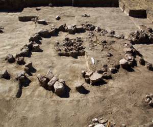
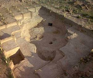
Krasnyi-Yar Copper Age Botai Culture settlement, Kazakhstan. Pit houses, hearths, and other features are mapped with magnetic and electrical resistance survey as part of research into the earliest horse domestication.
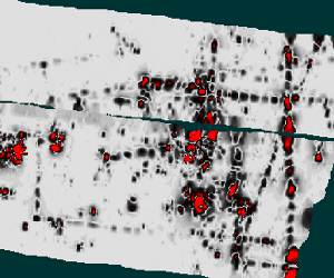
Location of Human Burials Geophysical methods can be used for locating unmarked graves and delineating cemetery boundaries on historic and precontact cemeteries. Because they are non-invasive, these methods are of particular importance in cemetery studies, where disturbance must be avoided.
The Cambria Site Large-area geophysical reconnaissance of a 19th century coal mine and company town.
The Eastep Site Investigating burned rock features and the transition to agriculture and sedentism in southeast Kansas.
Kerkenes Dag A fortified Iron Age settlement in Turkey, identified with Pteria, a capital city of the Median empire.
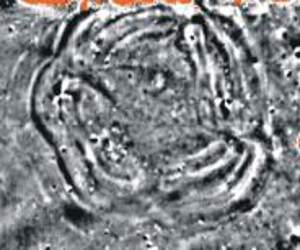
Sharps Creek Council Circle Earthworks and subsurface features are mapped magnetically at an Ancestral Wichita village site in Central Kansas.
See also: Publications by Archaeo-Physics staff